
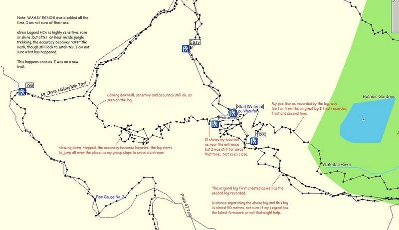
lfy81 wrote:Ok my simple review of my etrex Legend HCx, sensitive but not accurate enough.
A clearer and bigger picture in this below link because my picture upload limit is 800pixels
http://img.photobucket.com/albums/v502/ ... llse-1.jpg
There are some flaws to your method in determining the accuracy of the GPS.
First, you cannot use the track log. The dots to the track could be many seconds apart, and when you are using it in an offroad environment, the GPS is unable to lock on the road, so it will drift.
The particular section of the maps you are using could be done few years back so there could be some errors too. So if your track does not plot exactly on the line of the map, do get too worry.
The best way to determine the accuracy of the GPS without the need of all the fancy equipment, is to find a heli-pad. On most heli-pad, especially those in military areas, the GPS coordinate is displayed. So you can compared that with the actual reading of your GPS.
Above all, the garmin GPS are for hobbyists, so its take the accuracy can never be comparable to military GPS using P(Y) code.

 source link
