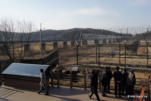
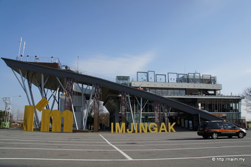
Seoul

Share your trip photos, tracklogs, experience & tips. Ask the locals info about your planned destination.

Moderators: Moderators, Regional Mappers

Forum rules
1. Be nice to each other and respect the moderators. Post in normal font size, color and weight. Follow Nettiquette
2. NO out of topic. Discuss matters pertaining MFM community and forum only.
3. NO abuse, profanity and insults
4. NO spamming, cross posting and opening of duplicate topics
5. NO advertisement post or link
6. NO post/link to warez, cracks, serials or illegally obtained copyrighted content
7. Each message posted is owned by and is the opinion of the original poster. Neither mfm nor its owner or moderators are legally responsible for anything posted on the forum
User avatar
naim
Posts: 212
Joined: Mon Apr 13, 2009 10:13 pm

Re: Seoul

Postby naim » Sat Dec 18, 2010 5:03 pm

stimix wrote:Wah very brave. I decided to skip DMZ after the Yeongpyeong Island bombing. :shock:


never been to dmz before, so on this my 3rd visit to seoul, i just had to do it. now 'amber alert' at dmz, hence many places restricted. that's why there was nobody on the road in my pic above. :D
Pls see my travelogues at http://naim.my - THANKS!

User avatar
naim
Posts: 212
Joined: Mon Apr 13, 2009 10:13 pm

Re: Seoul

Postby naim » Sun Dec 19, 2010 12:05 am

DMZ (Part 2)


Here at Imjingak, there's a heavily fortified area where visitors can soak in the tense atmosphere. The Freedom Bridge crossing the Imjin river can be clearly seen. The heavily fortified DMZ area is just about 3km away over the wooded hills.
Image

We are shown a simple motion sensor technology still in use at the DMZ. Stones are embedded in the fence, which will fall off if the fence is disturbed or cut. The falling stone will hit the metal railing at the bottom, thus making a sound audible to patrolling soldiers.
Image

And yes, armed guards are on constant patrols here too. I can imagine how jittery the situation is in the DMZ proper just 3km away, with the enemies within sight, all armed to the teeth, and a battle could start at any time. The DMZ is a border strip some 250km long and just 4km wide.
Image

Through the barbed wires and fencing, I spot something interesting - a huge flock of White-fronted Geese, wintering here from the even harsher winter of eastern Siberia. Here they are feeding on loose paddy in the fields. Yes, so close to North Korea, but the government gives incentives for farmers to plant the crop here, rather than idling the land.
Image

When the geese take flight, they make an awesome sight. The DMZ is a 250km by 4km strip untouched by human development. It makes an ideal conservation site for flora and fauna, and birds take full advantage of it. There are many endangered species living in peace in the DMZ, where they are free to come and go. Such irony.
Image

As a wave of geese fly away, maybe to North Korea, I see a wall of colourful ribbons to my right.
Image

These are ribbons of hope and well wishes left by visitors from all over the world.
Image

I found a pair of English messages, most likely typical of what're written on the other strips. Unification? Maybe not so fast. I visited poor East Germany (and East Berlin) when it existed. Instant reunification in 1990 caused prosperous 'West Germany' to suffer socio-economically. South Korea could fare even worse. So maybe best is to keep North and South separated initially, and just let them be friendly parties. Help North to 'catch up' first before attempting reunification.
Image

Behind me there's a relic of the terrible Korean War of 1950-53.
Image

The story tells it all.
Image

A short stroll away, a portion of the original Freedom Bridge is preserved. Just before armistice of the Korean War in 1953, thousands of refugees from the north straggled here to escape the communists at the last minute.
Image

Nearby, this monument cum altar was built for people like them, as a place to offer prayers for loved ones, dead and alive, left behind in North Korea.
Image

Indeed a poignant memorial for the only divided state in the world today.
Image

===
Pls see my travelogues at http://naim.my - THANKS!

User avatar
naim
Posts: 212
Joined: Mon Apr 13, 2009 10:13 pm

Re: Seoul

Postby naim » Mon Dec 20, 2010 2:16 pm

DMZ (Part 3 - FINAL)

As I said, Imjingak is a clever exploitation of the 'aura' of the DMZ. There's a tourist complex here, with the rooftop providing a platform to observe North Korean territory with powerful binoculars. It's particularly deserted today, save for our black MPV, thanks to the heightened tension due to the North Korean shelling of Yeonpyeong just 3 weeks ago. To venture closer to the border, visitors must leave cars here, register and board special buses for a fee, but the tour has been curtailed due to the prevailing 'amber alert'.
Image

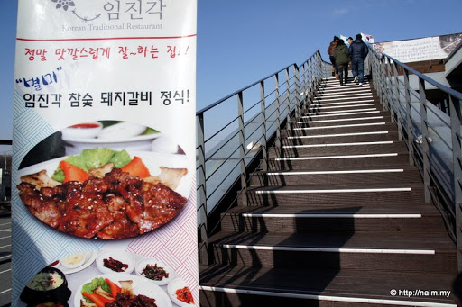
It's a bit of effort climbing up to the top, passing two floors of fancy restaurants and shops.
Image

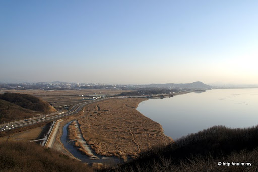
Pretty decent view from up here, and the mountains on the horizon are in North Korea. A tip: if a mountain is bald, then it's most likely North Korea because the trees have all been cut down for cooking fuel by the impoverished people. Suddenly I hear bursts of gunfire ... trrrrr! ... trrrrr! ... trrrrr! ... coming from beyond the hills. Hopefully just a live exercise, but it hits me that we are indeed in a hostile war zone. War can break out at any time.
Image

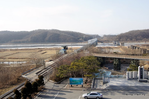
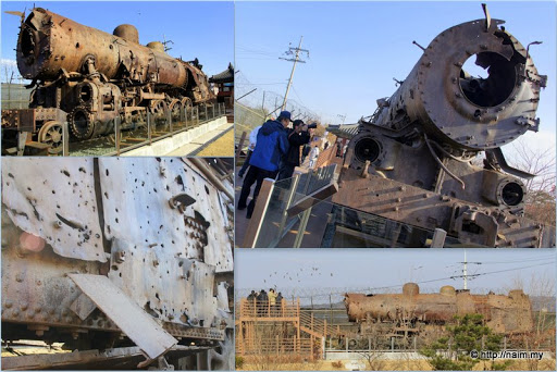
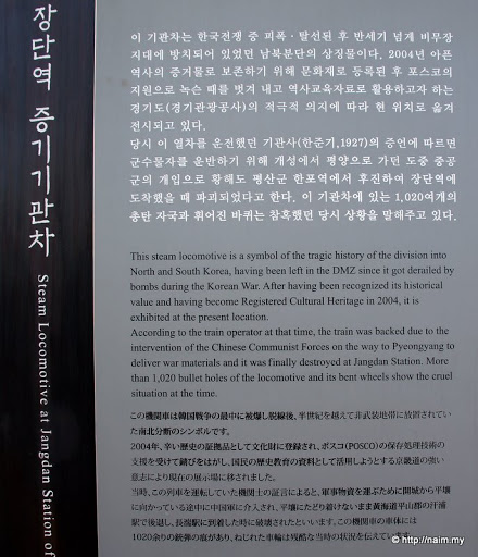
The rail line curves into the core DMZ area and on to Pyongyang (220km away), ready to service traffic between it and Seoul (60km behind me), if that ever happens. There's even a spanking new, functional Korail station just before the border, but is now still deserted.
Image

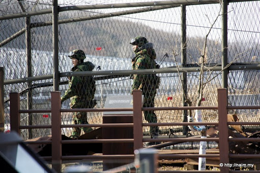
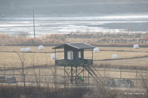
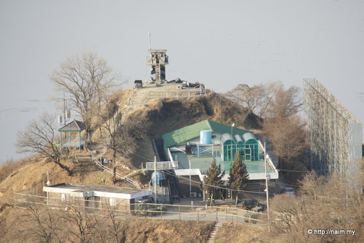
Another South Korean army post, next to the frozen Imjin river. Patrols by foot and jeep are very frequent.
Image

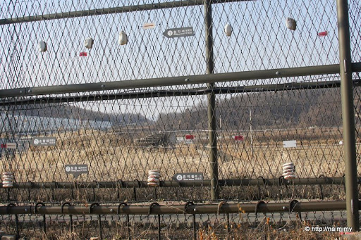
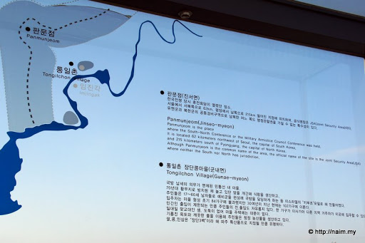
A useful map to orientate clueless visitors. Shows how close we are to the hostile border.
Image

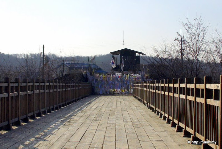
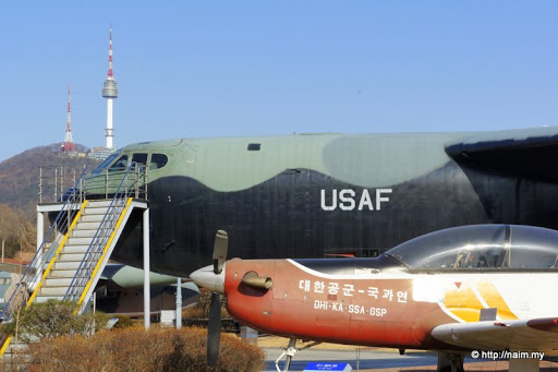
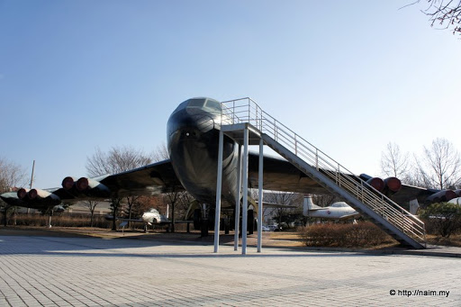
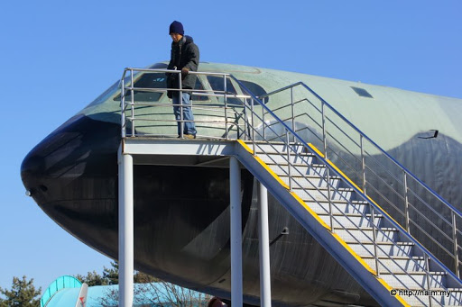
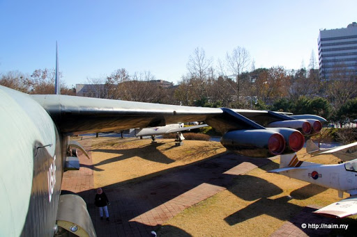
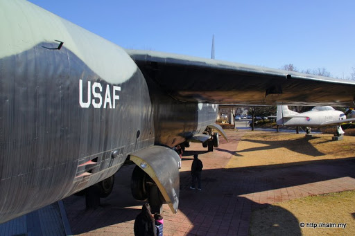
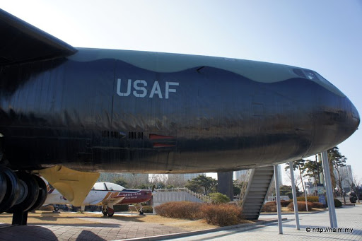
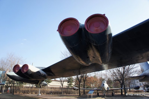
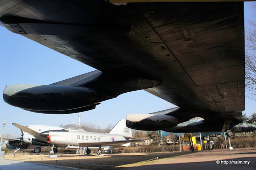
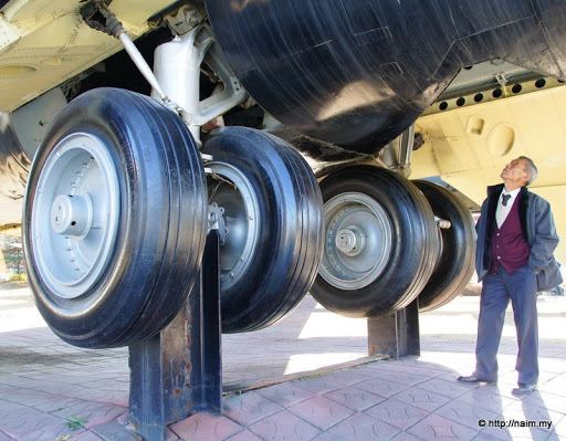
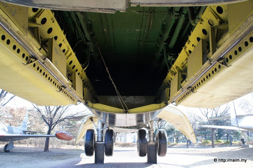
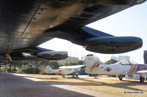
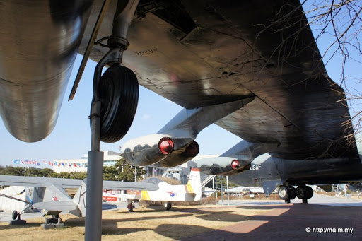
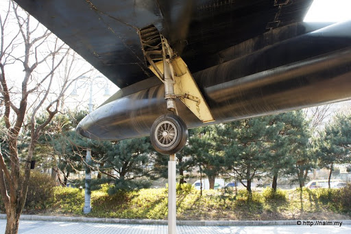
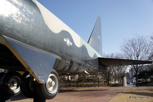
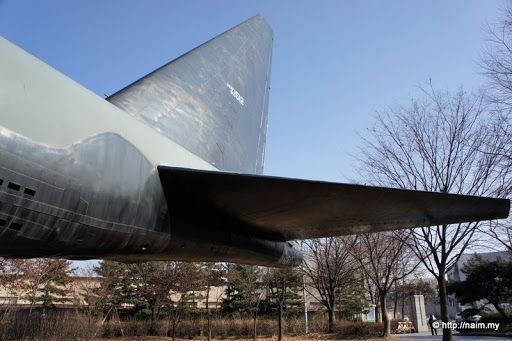
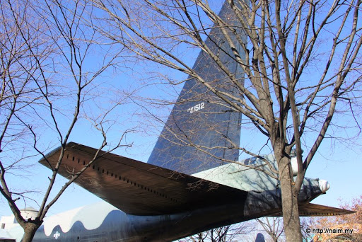
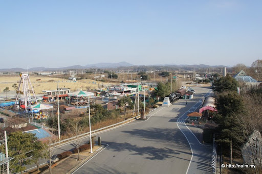
On the other side of the Imjingak visitor centre, there are funfair, memorials, sculptures, statues and Korean War-era military hardware such as tanks and planes on display. They have done pretty well in making this spot a major tourist attraction, but nobody's here today for obvious reasons ... except foolhardy us!
Image

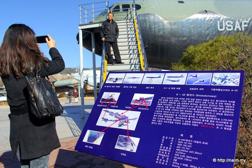
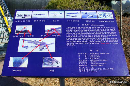
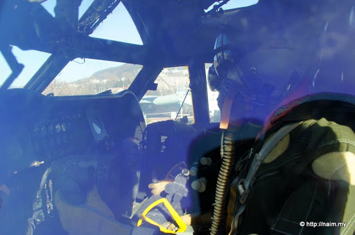
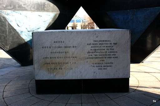
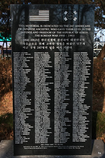
Saying thanks to the Americans for their very significant Korean War role ...
Image

... plus a special one.
Image

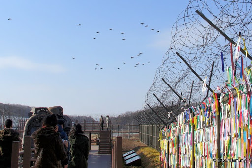
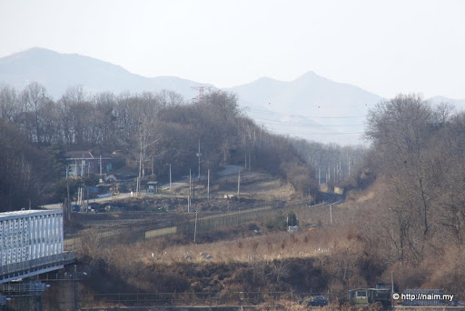
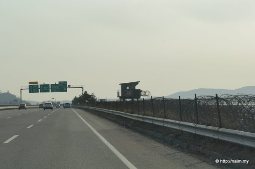
It's getting dark, we have another place to visit, and soon we are back on the highway which skirts the edge of the Imjin river, heavily fortified since the other river bank belongs to North Korea. This is a stretch of the river DMZ.
Image

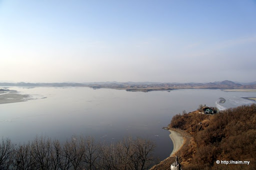
Our destination is the Odusan Observatory, built atop a hill overlooking the Han and Imjin rivers, and North Korea beyond them.
Image

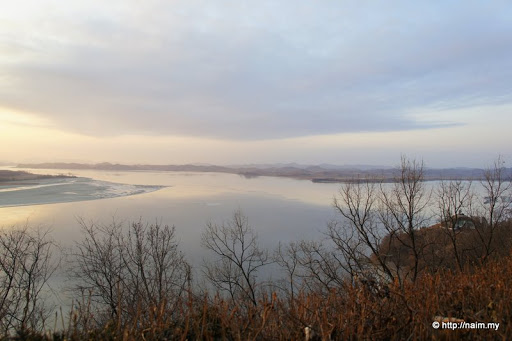
At Odusan, I view the confluence of the Imjin river (which we followed from Imjingak to the right) and the mighty Han river. Bottom right and extreme left are South Korean territories, the rest in front of us, North Korea. The Han river then flows into the Yellow Sea straight ahead (when it's not frozen like today) and is the site of several previous naval skirmishes between the two sides.
Image

At the narrowest point, it's only 3.2km separating North and South. From Odusan, I train my lens on North Korea. Scattered white buildings, but no signs of activities. No traffic, looks like a ghost town, these are probably show buildings only. I saw something similar when I crossed the border from West Berlin into East Berlin in 1988 - vacant buildings.
Image

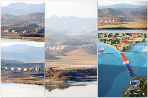
Below me, at a promontory where the two rivers meet, an army installation. Not surprised if they have artillery down there, ready to pound North Korea.
Image

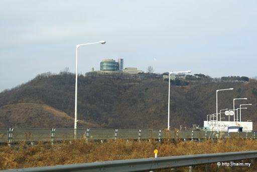
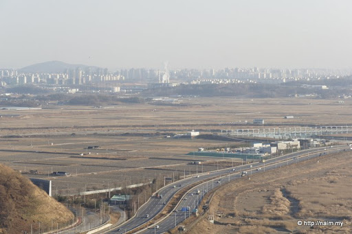
I look to the south towards Seoul and on the horizon, there's a new city.
Image

This is Paju, home to LG Display with its huge modern LCD plant. If war breaks out, Paju could be the first casualty. It's virtually a bordertown.
Image

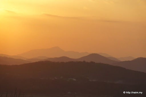
As the Sun sets on an extremely cold winter evening, the rivers and mountains at this dangerous frontier make a surreal picture.
Image

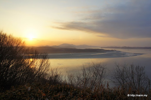
I glance back at North Korea, and the dusk makes it look even more mysterious. I wonder how a battle here would be.
Image

Look, the mountains still have trees, so they must be in South Korea. :)
Image

It's probably -10C now, colder when the occasional wind blows, but I quickly take off my beanie for a photoshoot with North Korea, just 4km behind me - the closest I'd ever get, until I make a trip to Pyongyang itself one fine day. :D
Image

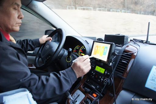
Brief DMZ visit done, Mr Han punches the GPS in his warm car to take us back to Seoul. What can I say, it has been a soul-searching trip, pun unintended, to see first-hand the only separated state in the world, and a hostile one at that.
Image

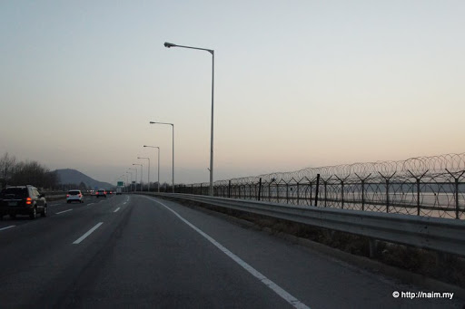
As we glide along the modern expressway back to Seoul, the intimidating fencing and barbed wire reminds us the fact that the two Koreas are still at war, and that the heavily-armed North is just a stone's throw away from dynamic Seoul, across the river literally. They are holding Seoul at ransom, while their own capital Pyongyang is at a relatively safe distance of 250km away. I do hope they'd become friends one fine day, after all they are the same people sharing the same proud history and traditions for almost 2,000 years. They are unwilling victims on the superpowers' chessboard.
Image


> THE END
Pls see my travelogues at http://naim.my - THANKS!

User avatar
naim
Posts: 212
Joined: Mon Apr 13, 2009 10:13 pm

Re: Seoul

Postby naim » Mon Dec 20, 2010 9:04 pm

i don't think there'll be a war, too much at stake for the string-pullers: usa, china, russia. skirmishes maybe, but full-scale war unlikely. that corner of asia is a key engine of growth globally.

our driver mr han, asked me on the way back, why did you go to dmz with war risk, dangerous? i said, since you (mr han) are willing to take us there, it must be safe. he just grinned. :)

escape plan? mr han driving the hell out of there!
Pls see my travelogues at http://naim.my - THANKS!

User avatar
JJ007
Valued Contributor
Posts: 211
Joined: Fri Sep 19, 2008 11:37 pm
Location: Singapore, Johor (and sometimes Batam)
Contact:

Re: Seoul

Postby JJ007 » Mon Dec 20, 2010 9:45 pm

saw the wall of colourfull ribbons that reminded me on my previous trip to DMZ at 2005. At that time, they were not so nicely displayed (far end), also there were some old photos which the S Korean display there to remind everyone the missing relatives.

from your pictures seem that the entire DMZ area are nicely built up now to become a tourist attraction spot. During 2005, it is simplier but at that time there was no special alert hence more tourists

P1000290.JPG

P1000288.JPG

P1000303-1.jpg


(bro naim, read your travelblog, very detail and nice photos, enjoy it, thanks for sharing)
You do not have the required permissions to view the files attached to this post.
Device : Edge 800, Nuvi 1460 SG/My, Oregon 300
EPL : Man United Rocks !

User avatar
naim
Posts: 212
Joined: Mon Apr 13, 2009 10:13 pm

Re: Seoul

Postby naim » Mon Dec 20, 2010 10:46 pm

thanks, jj, for your interesting 2005 pix. yes, the ribbons at the end of the bridge are still there.

Image
Pls see my travelogues at http://naim.my - THANKS!

User avatar
stimix
Moderator
Posts: 611
Joined: Mon Sep 15, 2008 7:53 pm
Location: Puchong Selangor (Garmin MXT Nokia N8)

Re: Seoul

Postby stimix » Tue Dec 21, 2010 6:14 pm

Suprisingly they don't stop you from entering DMZ as i was told that most tour guides there are closed during high alert :-k

The Joint security area (JSA) complex probably banned for all tourist? :-k
ImageImage
ImageImage

User avatar
naim
Posts: 212
Joined: Mon Apr 13, 2009 10:13 pm

Re: Seoul

Postby naim » Tue Dec 21, 2010 6:51 pm

stimix wrote:Suprisingly they don't stop you from entering DMZ as i was told that most tour guides there are closed during high alert :-k

The Joint security area (JSA) complex probably banned for all tourist? :-k


we hired a car and at the end of the empty highway there was a junction, one to panmunjom, the other to imjingak.

Image

i wanted to go to panmunjom, but driver han said, don't think can go, the military would stop us because of bad situation, so let's try imjingak. and imjingak was open, though deserted. but no private cars allowed further - got army checkpoint. at imjingak there was a special bus to take ppl deeper into dmz, but only 2 places to visit, the others closed because of amber alert. i skipped the bus offer and decided to go to odusan observatory instead.
Pls see my travelogues at http://naim.my - THANKS!

User avatar
naim
Posts: 212
Joined: Mon Apr 13, 2009 10:13 pm

Re: Seoul

Postby naim » Wed Dec 22, 2010 6:02 pm

The B-52

This is truly a pleasant surprise. On a fine bitterly cold morning last week, we took a walk (yeah, crazy idea at -5C) from our hotel in Yongsan towards Itaewon, and there next to the road, sat a B-52! I'd always wanted to see this (in)famous beast up close, so I just couldn't believe my luck. I was excited like a kid!

The awesome and fearsome B-52 Stratofortress with the iconic Seoul Tower in the background.
Image

You can climb up to view the flight deck ...
Image

... but only if you are not acrophobic, otherwise vertigo can set in. :)
Image

It's quite a nice spot for a pose, esp. in the bright morning light.
Image

Details on the displayed B-52, moved here March, 2009. Actual model is 'Boeing B-52D-65-BO Stratofortress'; C/N 17221, original USAF S/N 55-105.
Image

Yes, I go up to peek into the cockpit, but the lighting is bad. Looks cramped inside there, considering the huge size of the plane.
Image

I glance at the wingspan of 53m. This 'D' model started flying in 1956. It played a major in carpet-bombing Vietnam during the Vietnam War (1955-75). Bad, bad bird!
Image

The huge fuselage is almost 50m long, shorter than the winspan.
Image

It has a short stubby nose, and the flight deck has two floors - only the pilot and co-pilot occupy the top floor. The bottom floor is the office for the navigator, electronic warfare officer, and radar navigator cum bombardier.
Image

On each wing, 2 pods carry 2 powerful Pratt & Whitney engines each. Cruising speed is 850km/h, up to max height of almost 50,000ft. Combat radius is 7,200km, while ferry range is about 16,000km.
Image

The wing is huge and long, and the weight of the 4 engines plus the fuel will make it sag when not flying. So it's necessary to install a small landing gear, called the outrigger, at the end of the wing to support it when the plane lands and is on the ground.
Image

Massive main landing gear. This mafaka weighs more than 200 tonnes when full of bombs.
Image

That's where they store the fireworks, which brought misery to thousands of unfortunate people down below.
Image

The 4 engines on the port wing.
Image

Close-up of the outrigger at the tip of the port wing.
Image

There's a pod at the wingtip next to the outrigger. Am not sure what it is for; some radar stuff, or extra fuel?
Image

The fuselage is slender top-bottom, so when you look at the B-52 from the front, it looks rectangular.
Image

The majestic tail and stabiliser.
Image

Tail repainted with reg. USAF 50-1512. So now I can tick off B-52 from my list of planes to see. :)
Image

> THE END
Pls see my travelogues at http://naim.my - THANKS!


Return to “Holiday & Travel”

Who is online

Users browsing this forum: No registered users and 23 guests