Mapping Trip to Northern Thailand

Share your trip photos, tracklogs, experience & tips. Ask the locals info about your planned destination.

Moderators: Moderators, Regional Mappers

Forum rules
1. Be nice to each other and respect the moderators. Post in normal font size, color and weight. Follow Nettiquette
2. NO out of topic. Discuss matters pertaining MFM community and forum only.
3. NO abuse, profanity and insults
4. NO spamming, cross posting and opening of duplicate topics
5. NO advertisement post or link
6. NO post/link to warez, cracks, serials or illegally obtained copyrighted content
7. Each message posted is owned by and is the opinion of the original poster. Neither mfm nor its owner or moderators are legally responsible for anything posted on the forum
User avatar
KC*
Regional Mapper
Posts: 32
Joined: Sat Sep 20, 2008 8:28 pm
Location: Singapore

Mapping Trip to Northern Thailand

Postby KC* » Thu Dec 30, 2010 3:06 pm

Mapping the mountainous roads in Northern Thailand can be both challenging and fun. Here's a brief photo-tour of my recent track gathering exercise that ran alongside our annual medical aid-trip to the mountain villages off Chiang Mai and Chiang Rai.

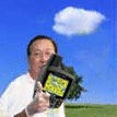
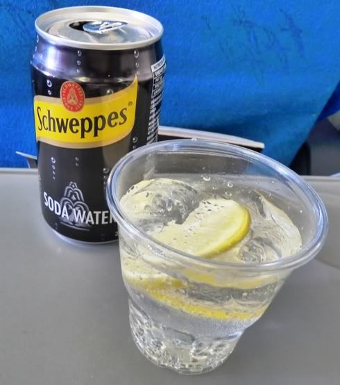
After packing my sleeping bag, instant coffee (non-existent in the villages) and bits of clothes, it was off on a Silk-Air flight to Chiang Mai. Soda Water - my favourite beverage!

01. Last cool refreshing drink on the flight before hitting the road on arrival.

Image


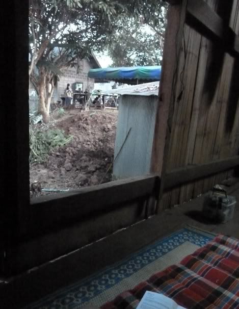
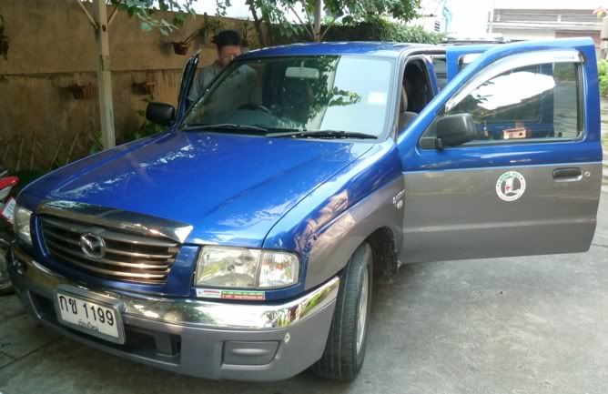
02. The rest of the team (comprising another 5 vehicles) were already in the mountains when I arrived in CNX. I joined them late as I was holidaying in Melbourne. On arrival, I picked up this 2WD Toyota Twin-Cab. Needed the open back for loading medical supplies.

Image


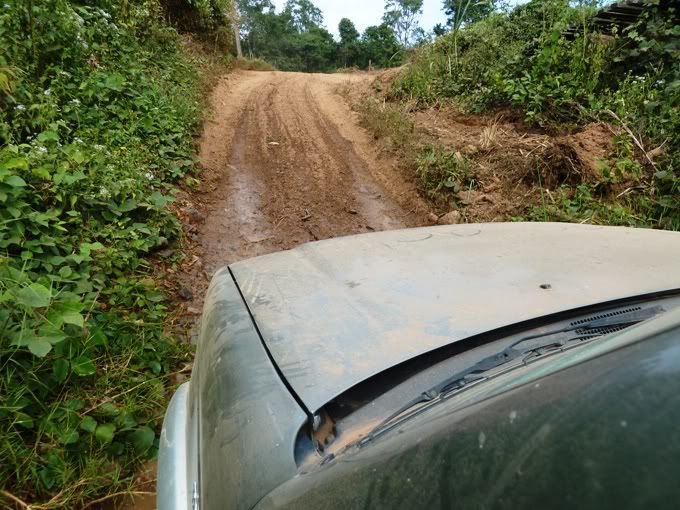
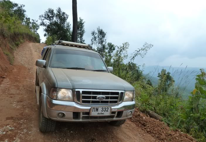
03. The Toyota was fine on open roads but I traded it for this 4WD Ford Ranger for navigating the mountain tracks.

Image


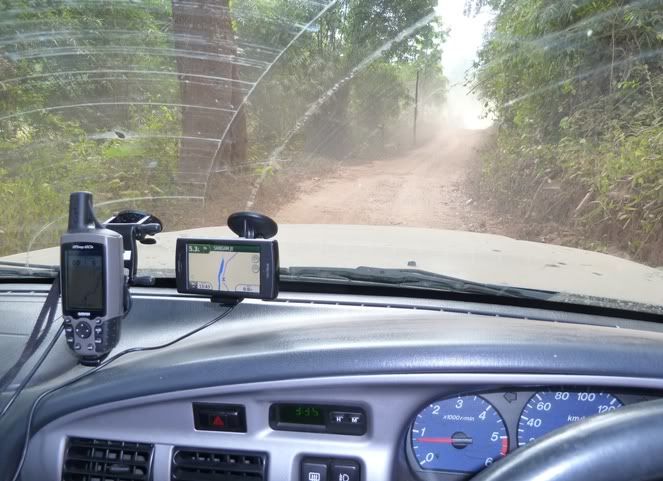
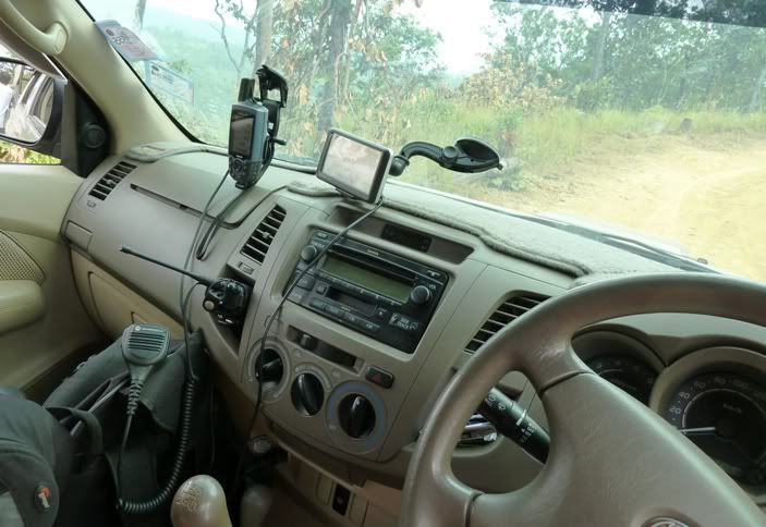
04. Here's a shot of the equipment mounted on my Ford. I have a borrowed GPSMap 60CSx for track-logging and a Nuviphone for navigation. We also use 2-Way Radios for communication - this one is fitted with a Motorola GP2000 with Palm Mic. With 4W UHF Output, it is excellent for convoys.

Image

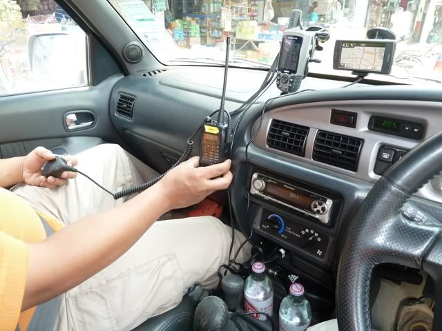
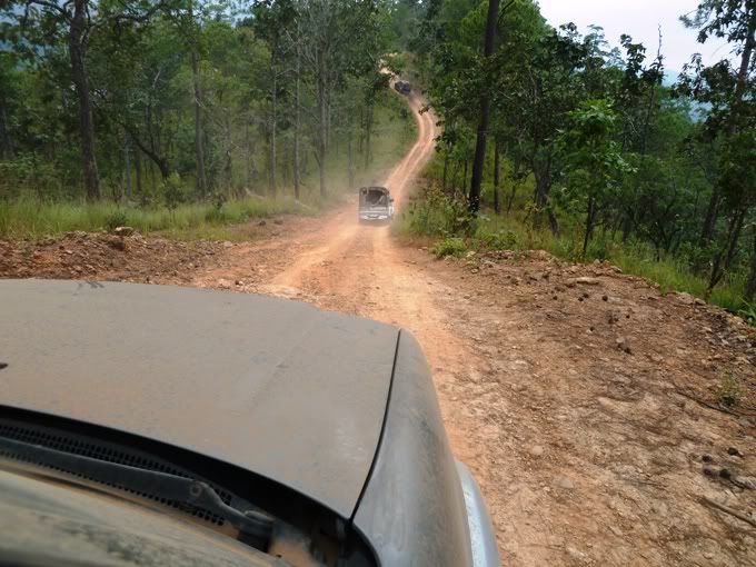
05. Here's another one of our vehicles - a Toyota Hilux 4WD. These Turbo-Diesels have tremendous torque. We had 2 of these beasts. I had another GPS60C mounted for tracklogging and Nuvis for navigation.

Image

Image

more....

User avatar
KC*
Regional Mapper
Posts: 32
Joined: Sat Sep 20, 2008 8:28 pm
Location: Singapore

Re: Mapping Trip to Northern Thailand

Postby KC* » Thu Dec 30, 2010 3:07 pm

06 Mountain Roads can be tricky. Even highways can turn into narrow single lane cement paths and unpaved roads along certain stretches. Having the right vehicle is crucial. Unpaved roads can be dusty in the dry weather and we keep a good distance from each other. On wet days, they turn into mud paths and can be dangerous.

Image

07 Here are my trusty GPSrs firmly mounted on the windscreen, surviving the endless bumps and rattles.

Image

08 Occasionally, we were confronted with choices. Here's one: Should I take the wooden bridge with my heavily laden vehicle or into the stream?

Image

09 The answer is obvious. Hee... :mrgreen:

Image

Image

more...
Last edited by KC* on Thu Dec 30, 2010 4:44 pm, edited 1 time in total.

User avatar
KC*
Regional Mapper
Posts: 32
Joined: Sat Sep 20, 2008 8:28 pm
Location: Singapore

Re: Mapping Trip to Northern Thailand

Postby KC* » Thu Dec 30, 2010 3:07 pm

10 Some drives may not be long in terms of distance, but can be tiring. At each destination, we'd set up clinic and often work into the night. Then we'd roll out our sleeping bags and have our well deserved rest. Here is my comfy spot in the home of a villager, complete with a view of the outdoor toilet, pigs and stray dogs. :zzz:

Image

11 After 2 weeks, my vehicle has collected a thick layer of dirt. Some strange words started appearing... :-'

Image

12 OK... hint taken. End of trip, we hit the pubs in Chiang Mai and get our well deserved...

Image

Now I am back in my office (idling away... heee). Tracks and POIs from our GPSMap60C and 60CSx have been downloaded and will be sorted out over the next few weeks.

So that was how the N Thailand map was built over the last 10 years - along with the generous contributions from fellow track-loggers from all over. To all who contributed and for spending time reading this thread, I'd like to say :tq:

User avatar
stimix
Moderator
Posts: 611
Joined: Mon Sep 15, 2008 7:53 pm
Location: Puchong Selangor (Garmin MXT Nokia N8)

Re: Mapping Trip to Northern Thailand

Postby stimix » Sat Jan 01, 2011 3:34 pm

Wow :shock: :prayer:

Mapping to the extreme :mrgreen: esp from the original Northern Thailand mapper himself :prayer:
ImageImage
ImageImage

User avatar
cruiser
Posts: 601
Joined: Wed Sep 17, 2008 10:55 pm
Location: NL - Nuvi® 3790 SG/MY, 1490Tv, 775T, 650, 4980 & TTom GO 910 + 950 Live, GO 6000

Re: Mapping Trip to Northern Thailand

Postby cruiser » Sat Jan 01, 2011 11:55 pm

KC* wrote:Now I am back in my office (idling away... heee). Tracks and POIs from our GPSMap60C and 60CSx have been downloaded and will be sorted out over the next few weeks.

So that was how the N Thailand map was built over the last 10 years - along with the generous contributions from fellow track-loggers from all over. To all who contributed and for spending time reading this thread, I'd like to say :tq:


TQ brudder KC for sharing those pics... it sure brought back some great spending times I had in 2006 up in ChiangMai (Was there 4x) and 3x in 2007. I do and am considering yr switch from the Toyo to the Ford 4WD... as I'm also heading for BKK and Hua Hin this summer and placed a reservation for a Toyo 4WD SUV as the Rental Co has no Ranger in their fleet.

Will PM you instead on more details soon. Great to see you are a Guinness guy yrself... :mrgreen:

Cheersch as we say it by us here.... :thumbsup:

Image
Image ~ Cruiser ~

User avatar
GoSpeed
Posts: 8
Joined: Fri Jun 18, 2010 4:41 pm
Location: Peninsular Malaysia
Contact:

Re: Mapping Trip to Northern Thailand

Postby GoSpeed » Sun Jan 02, 2011 12:03 am

yum.. delizious offroad tracking... :thumbsup:
Image
Image
You need for Speed? GoSPEED GPS ! it's customized skin.. 8-)


Return to “Holiday & Travel”

Who is online

Users browsing this forum: No registered users and 22 guests