


Kepong Updates.
Updated 663 -sunn
Kepong Track
Moderators: shawchyn, Moderators, Regional Mappers
Forum rules
1. Be nice to each other and respect the moderators. Post in normal font size, color and weight. Follow Nettiquette
2. NO out of topic. This forum is strictly for feedback to our maps
3. NO posting of data copied from other source especially malsingmaps
4. NO abuse, profanity and insults
5. NO spamming, cross posting and opening of duplicate topics
6. NO post/link to warez, cracks, serials or illegally obtained copyrighted content
7. Each message posted is owned by and is the opinion of the original poster. Neither mfm nor its owner or moderators are legally responsible for anything posted on the forum
Re: Kepong Track
You do not have the required permissions to view the files attached to this post.
Re: Kepong Track
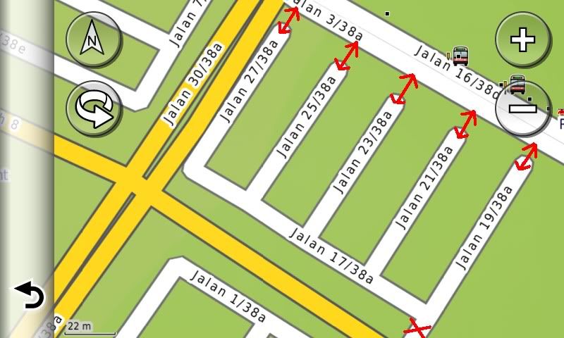
The Red Arrow is link track
The Red "X" is no link track (walking only)
Taman Sri Sinar, Kepong
(N03 11.295 , E101 39.069)
(JALAN 19/38A, 21/38A, 23/38A, 25/38A, 27/38A is link to 3/38A)
Updated 671 -sunn
Return to “KL & Selangor Map Feedback”
Who is online
Users browsing this forum: No registered users and 44 guests