Okay. Let's start our junction view project, whether for papago or Garmin or other maps later on. For a start, we need Junction View Photo contribution for Major Expressway and Highway exit.
A simple guidelines:
1. Take the photo in a clear sky morning, better to be Saturday or Sunday where there is less traffic.
2. It is better to have a photographer and a driver in your car. Don't risk your life.
3. Set your camera setting to highest mega pixels photo.
4. Set your camera setting to Infinity/Landscape/Sport mode.
5. Drive on the lane next to the exit lane when approaching Junction.
6. Take one photo showing clearly the major Signboard.
7. Take another photo nearer to the junction.
8. Save the junction location with your gps unit/data logger. You might need to use mapsource to adjust your waypoint a bit to the exact junction location.
9. Save your picture using mfm standard file name:
E.g. MFMJV_524909_10047280_1
Where 524909 is Lat without decimal, 1004728 is Lon without decimal and 1/2 for the photo numbering.
10. Zip your picture files and PM to Antyong. If the file is very big, use free one-click hostings such as Megaupload to host your files and PM the link to Antyong.
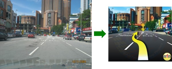
Example:
Happy Contributing.